
Living in Benafim: The Honest Guide to the Village Sitting on the Algarve's Biggest Aquifer
They say Benafim was built here for one reason: water. But look around and there's no river, no lake, not even a visible stream. So where is it?
Underground. Benafim sits on the Querença-Silves aquifer system, a 318-square-kilometre underground reservoir that is the most important aquifer in the Algarve and one of the key water sources for the entire region. Back before anyone knew the science, the old farmers read the land: the greenest trees, the dampest soil, the spots where goats stopped to drink. That's where they dug. And in Benafim, sooner or later, they'd hit water.
We visited Benafim as part of our Algarve Unlocked series. It's a quiet, fascinating place that raises bigger questions about water, rural decline, and what keeps a village alive.
📺 This article is a companion piece to our Algarve Unlocked video on Benafim. Watch the full episode for the walking tour, the breakfast at Quinta do Freixo, the interview with Anna from Ukraine, and the drone footage.
Where Exactly Is Benafim?
Benafim is a former civil parish in the municipality of Loulé, now part of the merged parish of Querença, Tôr e Benafim (created in the 2013 administrative reform). According to the Loulé municipal website, the parish had just over 1,200 inhabitants before the merger. The village itself is smaller, with Nick estimating around 400 people in the settlement proper.
It sits on the N124, a lesser-known country road that starts down in Lagoa to the southwest, runs northeast through Silves (the ancient Moorish capital of the Algarve), continues through Messines and Alte, passes directly through Benafim, and then on to Salir before eventually petering out near Alcoutim on the Spanish border.
In practical terms, it's about 20 minutes from Loulé by car and about 30 minutes down to the coast. Bus route 89 runs from Loulé to Messines with a stop in Benafim, and you can also catch the 83 to Salir. But as with all inland Algarve, a car is the realistic option.
The village sits in a transitional zone between the Barrocal and the Serra do Caldeirão, in an area characterised by limestone landscapes, cork oaks, and the kind of quiet that city people sometimes find unsettling.
The Aquifer: Why Benafim Exists
The Querença-Silves aquifer system is the largest and most important aquifer in the Algarve. It spans approximately 318 square kilometres of water-bearing limestone rock, and according to multiple academic studies, it has historically been crucial for both public water supply and agricultural irrigation across the region.
What those old farmers poking around in the dirt didn't know was that they were sitting on this enormous underground resource. When rain falls, it filters through the porous limestone and collects in the aquifer below, creating a natural reservoir that has supplied the Algarve with water for centuries.
Around the village you can still see the old infrastructure that communities built around water: noras (old water wheels once turned by donkeys, lifting water bucket by bucket), cisternas to catch rain, poços (wells) to reach the aquifer, stone channels that carried water to fields, and fontes (village fountains) where daily life once revolved. Nick first learned about these systems at the Water Museum in Querença, which explains how communities across the Algarve built entire systems around this precious resource.
This isn't just historical interest. As Nick pointed out, with the Algarve increasingly facing drought conditions and growing demand from tourism and agriculture, the aquifer matters more than ever. Recent good rains have helped, but water scarcity is a real and ongoing concern for local politicians and communities alike.
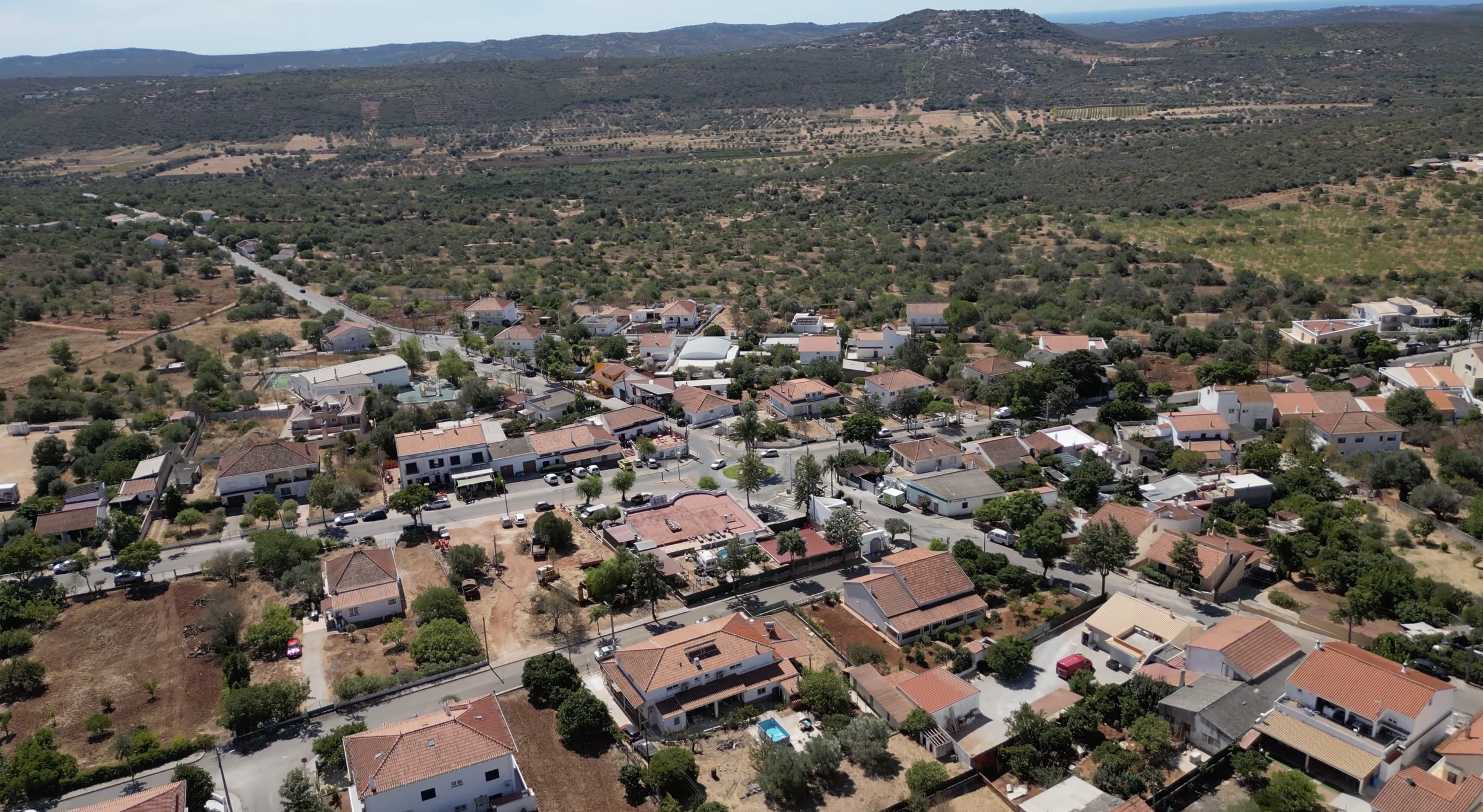
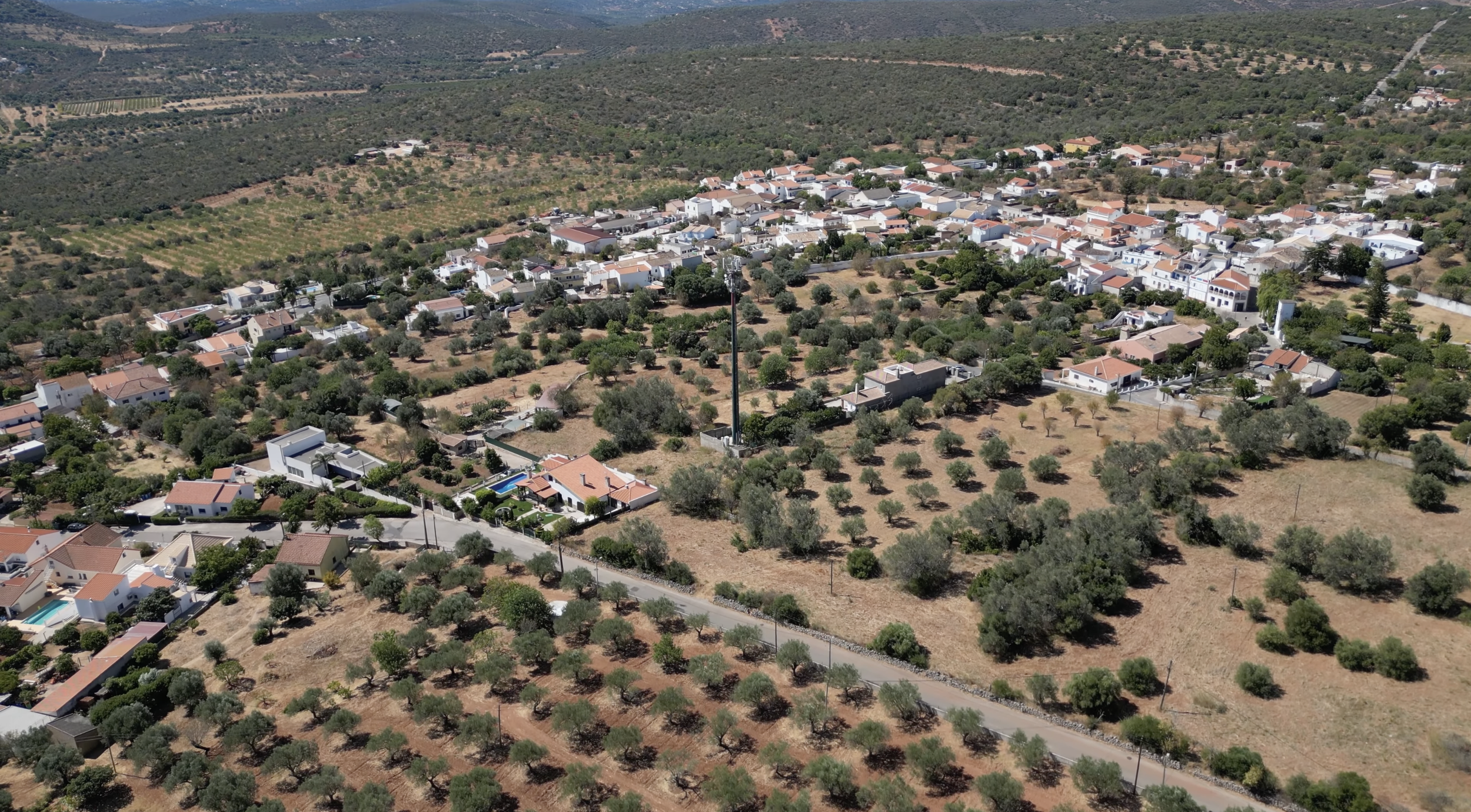
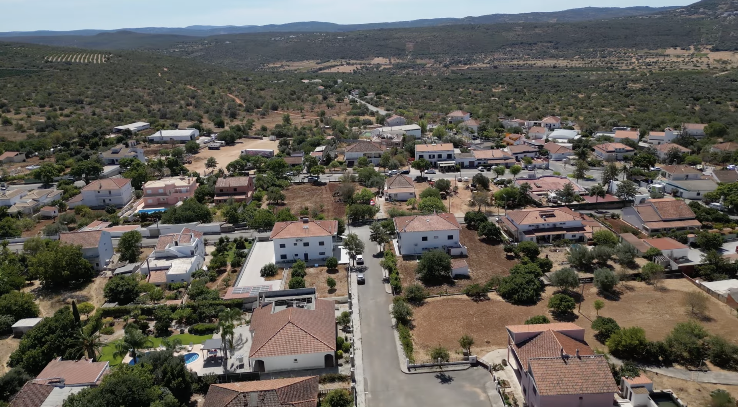
What Does the Village Look Like?
Benafim has an unusual two-part structure. The newer eastern section has a central roundabout with a bar, snack bars, a petrol station, a sports centre, and a Coviran supermarket. There's a pharmacy up the road.
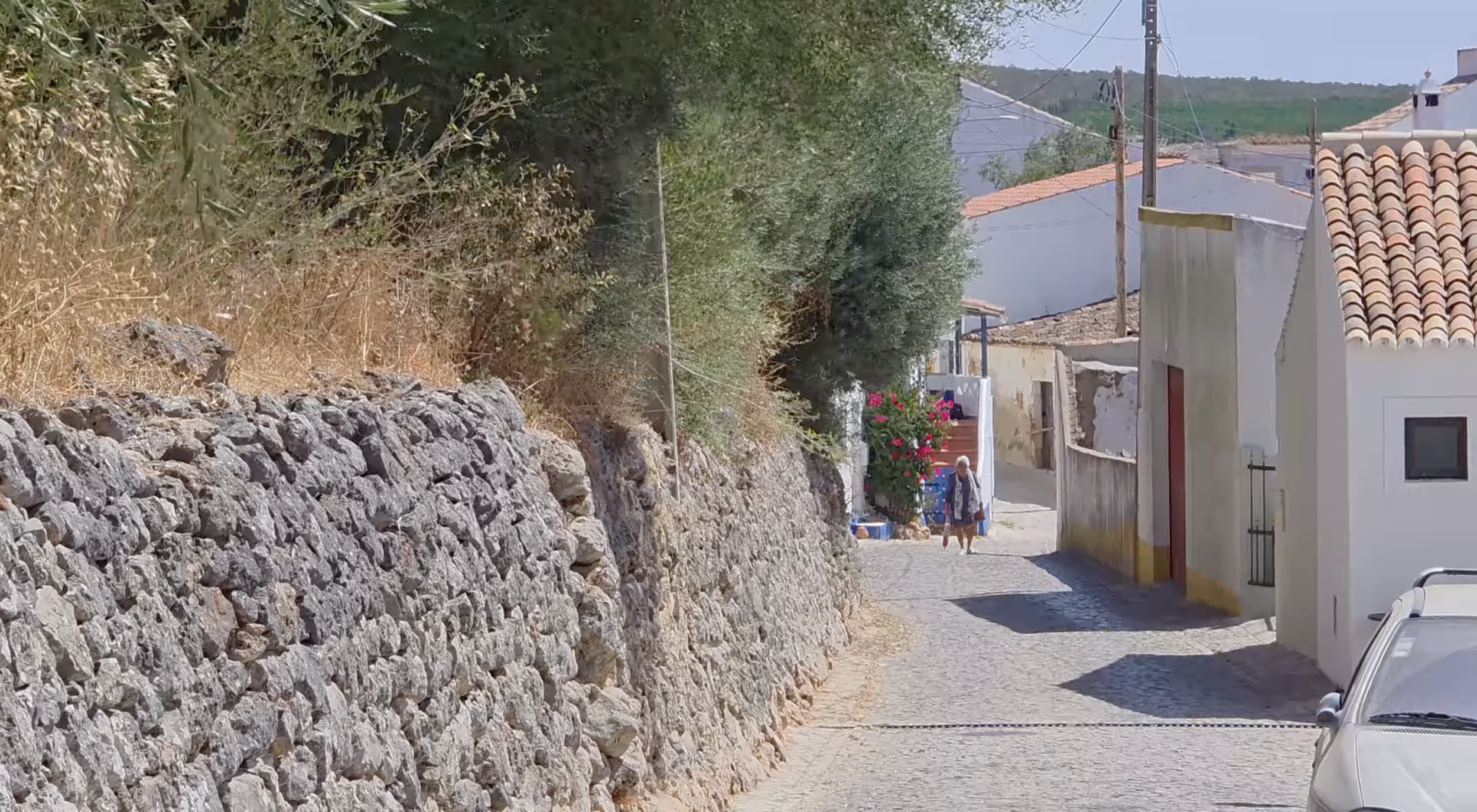
The western part thins out and climbs up to the old town, where the church sits at the top of the hill, beautifully restored and apparently gorgeously lit at night (an elderly local woman insisted Nick come back after dark to see it). Above the church, at the highest point, is the water reservoir.
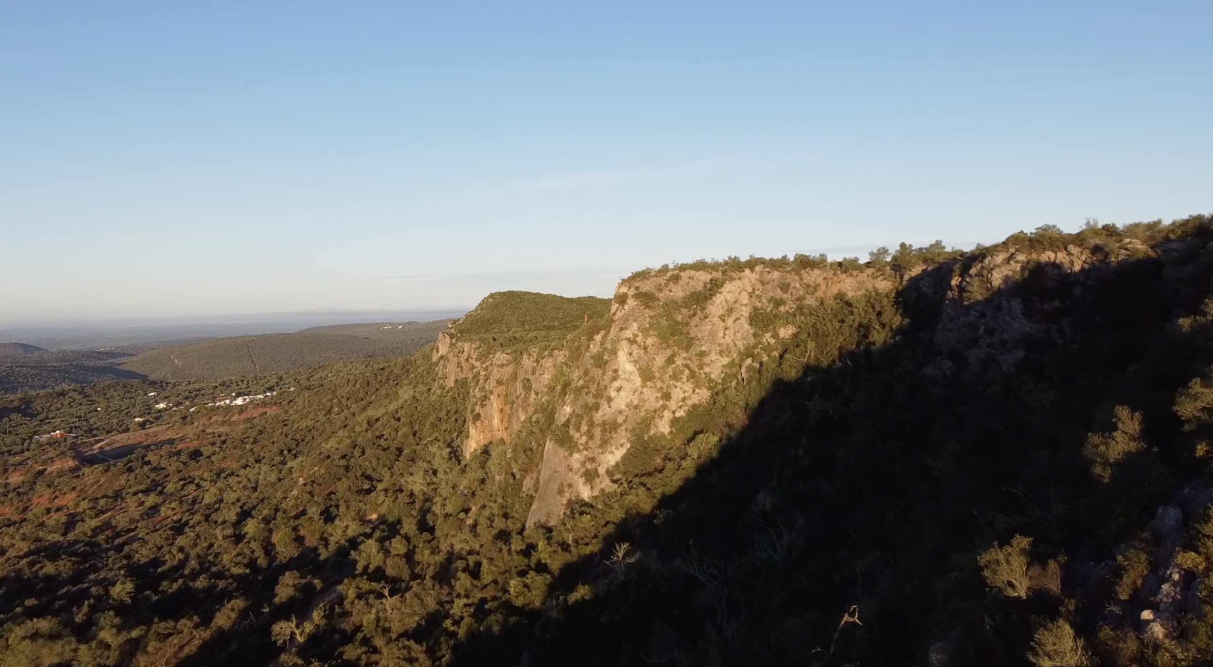
Just north of the village, you can see the impressive Rocha da Pena, a dramatic tabletop limestone massif reaching 479 metres, classified as a Local Protected Landscape since 1993. It covers 637 hectares and was historically home to Moorish fortifications. It's now a popular spot for hiking and nature activities, though use is limited to protect its natural values.
Benafim Pequeno is a small neighbouring settlement to the west, described by the Geopark Algarvensis as a "traditional architectural ensemble" worth visiting for its fountain and preserved rural character.
The village is also crossed by the Via Algarviana, the long-distance pedestrian trail running approximately 300 kilometres through the interior of the Algarve.
What's in Benafim?
For amenities, there's a pharmacy, a crèche near the social centre (which also functions as a care home for elderly residents), and a primary school. For doctors, Nick noted you may need to head to Salir or Alte, and Loulé hospital (an international private hospital where English is spoken) is about 18 minutes' drive away.
The Geopark Algarvensis website lists Benafim's must-see spots as including the Rocha da Pena, the village square, Benafim Pequeno, a picnic park under a monumental holm oak, a mini museum in the nearby hamlet of Penina, and the Ribeira de Algibre weir.
For food, there's a snack bar near the central roundabout, and Hamburgo restaurant, which Nick mentioned as one of the larger restaurants in town but hadn't eaten at. Quinta do Freixo is a bed and breakfast/agro-tourism just outside the village where Nick had breakfast and met Anna (more on her below). According to the Loulé municipal website, Quinta do Freixo is the most important tourism development in the parish, offering accommodation, dining, organic food production, and walking trails.
Anna's Perspective: A Resident's View
Nick met Anna, a Ukrainian woman who relocated to a property between Benafim and Salir after the start of the war. She chose the area because Portugal is the furthest point from Russia within continental Europe.
Her practical insights were useful: shopping is mostly in Loulé (about 20 minutes), with Continente being the main large supermarket. Mar Shopping in Loulé has IKEA and Leroy Merlin, which she visits frequently while building her house. For medical labs (blood tests and similar), there are options in Salir. For hospital care, the Loulé hospital is the go-to.
What struck her most was the abundance of nature: fruit trees everywhere, neighbours willing to share their produce, and a sense of safety that drew her to this remote spot in the first place.
The Traditions
Benafim has two main annual celebrations. According to the Geopark Algarvensis, the festival in honour of Nossa Senhora da Glória (Our Lady of Glory), the patron saint of Benafim, takes place on the third Saturday of October (the Loulé municipal website gives the date as 23 October). There's also a maize festival in August, which celebrates the grain's traditional uses and coincides with the period when emigrants typically return home for holidays.
The Geopark also notes that local handicrafts include lacework, embroidery, and patchwork, developed by artisans based in the nearby hamlet of Zimbral.
Could You Actually Live Here?
Benafim is the kind of place where the answer depends entirely on what you're looking for. It's tiny, it's quiet, and when Nick visited, he couldn't have seen 40 people despite a population of over 400.
The beautifully restored houses sit right next to crumbling ruins, and Nick noticed what felt like massive opportunities for buyers willing to take on a renovation project. Two elderly locals tried to sell him every house in the village, which gives you a sense of both the availability and the challenge: there are properties here, but who's coming to buy them?
This is the bigger question Nick raised in the video: what stops villages like Benafim from becoming totally abandoned, like so many others across rural Portugal? It requires investment, financial incentives, something to stimulate small businesses. But business often brings environmental degradation. It's a difficult balance, and one that communities like Benafim are quietly facing.
For the right person, though, this is a genuine opportunity. You're 20 minutes from Loulé, 30 minutes from the beach, sitting in spectacular Barrocal countryside on top of the Algarve's most important water source. Property prices are low by any Algarve standard. The nature is extraordinary. And if you're the kind of person who finds peace in silence, Benafim has that in abundance.
Benafim at a Glance
Municipality: Loulé Parish: Querença, Tôr e Benafim (merged 2013)
Village population: approximately 400 (parish formerly ~1,200)
Location: Inland Algarve, on the N124, in the Barrocal between Alte and Salir
Loulé: approximately 20 minutes by car
Nearest beach: approximately 30 minutes by car
Faro airport: approximately 30 minutes by car
Public transport: Bus routes 89 (Loulé-Messines) and 83 (Salir-Loulé via Tôr)
Schools: Primary school; crèche at social centre
Health facilities: Pharmacy in village; doctors in Salir/Alte; Loulé hospital 18 minutes
Shopping: Coviran supermarket; Loulé for full services
Key features: Querença-Silves aquifer (318 km², largest in the Algarve), Rocha da Pena (479m, Local Protected Landscape), Via Algarviana trail, Quinta do Freixo agro-tourism, Benafim Pequeno traditional settlement
Frequently Asked Questions
What is the Querença-Silves aquifer? It's the largest and most important aquifer system in the Algarve, spanning approximately 318 square kilometres of water-bearing limestone rock. It supplies water for both public consumption and agriculture across the region. Benafim sits directly on top of it.
Is Benafim near anything? It's closer to things than it looks. Loulé is 20 minutes by car, the beach is about 30 minutes, and Faro airport is roughly 30 minutes. The villages of Alte, Salir, and Querença are all nearby. It feels remote, but it's not isolated.
What's the Rocha da Pena? A dramatic limestone massif reaching 479 metres, located about 2 kilometres from Benafim. It's been classified as a Local Protected Landscape since 1993 and covers 637 hectares. It has caves formed by water action on limestone and offers panoramic views of the coast and the Barrocal from its summit.
Is there a name origin for Benafim? According to the Geopark Algarvensis, "Benafim" is a toponym of Arabic origin, formerly "Ben Afon," meaning "son of Afon." Tradition holds that this was the country house of the Moorish kings of Silves.
Are there properties for sale? Nick observed both restored houses and crumbling ruins available in the village. Property prices are low compared to the coast. If you're interested in the area, get in touch with us and we can help you explore options.
Thinking about relocating to the Algarve? We've been helping people make the move since our earliest days as a YouTube channel, and today we're a fully licensed real estate agency and certified tour operator. Whether you need help finding a home, understanding the visa process, or just want someone to show you around, get in touch through our website and let's chat about making the Algarve work for you. You can also explore our full range of relocation services here.